10 Geospatial mapping use cases you can’t ignore


The environment is being mapped in ways that are redefining how we live, work and make decisions. Understanding shifting urban dynamics is the first step in optimising global supply chains. Geospatial data has become the silent factor behind smarter, faster and more sustainable choices across industries.
At its core, geospatial mapping involves combining location data with analytical intelligence to reveal patterns, predict outcomes and solve complex problems. When data is given spatial context, it transforms from static information into actionable insight.
In this article, we explore 10 geospatial mapping use cases that are building the future of technology, business and society. Each example demonstrates how organisations are leveraging the potential of spatial data to drive measurable impact and enhance efficiency, resilience, or innovation.
Why is geospatial mapping a game-changer?
Geospatial mapping involves collecting, visualising and analysing geographic data, enabling organisations to understand where things happen and why it matters. Adding spatial intelligence to decision-making helps businesses to respond to challenges more precisely.
It powers a wide variety of applications, including optimising logistics, monitoring infrastructure, guiding autonomous vehicles, and protecting natural resources. Geospatial mapping transforms raw location data into information that can be used to drive smarter operations, better planning and more sustainable outcomes.
The benefits are both strategic and measurable. Many companies improve their efficiency by optimising their routes and workflows, achieving greater accuracy through real-time analytics, enhancing their resilience through predictive insights and enabling more personalised customer experiences through location-aware services. This growing importance is created by technological convergence. The rise of the IoT, 5G, artificial intelligence, and high-resolution satellite imagery has made location data more detailed, timely, and valuable than ever before.
As industries continue to digitise, knowing where events occur is becoming as important as knowing what or why. In this context, geospatial mapping forms the basis of strategy and provides a competitive advantage in the current market.
Check out our geospatial offerings!
Read more10 High-impact geospatial mapping use cases driving technological progress
Organisations and companies around the world use geospatial mapping for a variety of reasons and in many different ways. Some are looking to create additional business value, improve navigation and planning, and provide benefits for customers and employees.
Autonomous vehicles & smart navigation
Autonomous vehicles depend on high-definition mapping systems that combine LiDAR point clouds, radar data and camera imagery with centimetre-level precision. These dynamic maps are updated in real time using edge computing and V2X (vehicle-to-everything) communication technology to reflect changes in traffic, construction zones or weather conditions.
Geospatial AI models analyse spatio-temporal data to support localisation, path planning and obstacle avoidance, ensuring safe and efficient navigation in real time. As sensor fusion and real-time SLAM (simultaneous localisation and mapping) algorithms advance, high-definition geospatial mapping is establishing itself as the backbone of intelligent mobility ecosystems.
Supply chain & logistics optimisation
Modern logistics platforms use geospatial data from GPS sensors, IoT devices and satellite imagery to provide full visibility of the supply chain. Integrating GIS with machine learning enables organisations to perform predictive route optimisation that considers traffic, weather patterns and carbon footprint constraints.
Advanced spatial analytics can detect bottlenecks, optimise delivery clustering and support geofencing for warehouse automation. When combined with digital twins of transport networks, geospatial mapping is transforming the resilience and sustainability of supply chains.
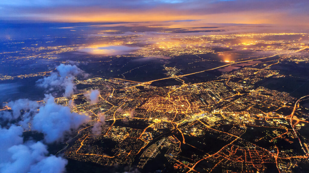
Smart city planning & management
Smart cities rely on geospatial mapping to efficiently orchestrate infrastructure, mobility and energy systems. Spatial data from IoT sensors, drones, and satellite feeds is integrated within GIS-based digital twins that simulate urban behaviour in real time. This allows for predictive traffic control, optimised waste collection and adaptive public transport routing.
Urban planners use 3D geospatial models to analyse land use patterns, forecast growth and assess environmental impact, thereby bridging the gap between physical and digital urban ecosystems through spatial intelligence.
Agriculture & precision farming
In precision agriculture, geospatial mapping is fundamental to a data-driven approach to crop management. Satellite imagery (e.g. Sentinel and Landsat) and multispectral data collected by drones are processed using AI to assess vegetation indices (e.g. NDVI and SAVI), detect nutrient deficiencies and optimise irrigation. Farmers can combine these with soil moisture mapping and topographic data to automate variable-rate seeding and fertilisation.
Machine learning models, which are trained using historical yield and climate data, enable predictive harvesting and improve resource efficiency. Geospatial analytics is improving productivity and enabling sustainable, regenerative farming practices to be implemented on a large scale.
Retail site selection & competitor analysis
Retailers are increasingly using geospatial mapping in conjunction with demographic, mobility and behavioural datasets to inform their expansion strategies. Spatial clustering algorithms and heat maps reveal areas with high customer potential, while AI models correlate footfall data with socioeconomic variables. Integrating point of interest databases and competitor mapping enables companies to evaluate market saturation and optimise store placement. Using 3D visualisation tools and spatial demand forecasting, decision-makers can mitigate investment risks and maximise ROI on new retail sites.
Disaster response & emergency management
During crises such as wildfires, floods or earthquakes, real-time geospatial mapping is essential for understanding the situation. Satellite constellations such as Copernicus and PlanetScope provide continuous observation of the Earth, while drones deliver high-resolution imagery for assessing damage. AI-driven change detection algorithms identify affected areas and spatial-temporal analytics support the planning of evacuation routes and the allocation of resources. When integrated with edge computing and public alerting systems, these geospatial insights can reduce response times and save lives, transforming the way emergency services operate in crisis situations.
Utilities & infrastructure maintenance
Utility providers depend on geospatial mapping to manage their dispersed mission-critical assets, such as pipelines, power grids and water systems. GIS-integrated asset management platforms use IoT telemetry, SCADA data, and satellite interferometry (InSAR) to detect faults, predict failures, and schedule proactive maintenance. Machine learning models analyse spatial data to forecast degradation patterns and risks of vegetation encroachment. When combined with drone inspections and 3D modelling, utilities gain a unified operational view, enabling predictive maintenance and minimising costly downtime.
Telecommunications & 5G network planning
The deployment of 5G requires dense and precise network planning, for which geospatial mapping is essential. Operators use LiDAR-based 3D mapping and ray-tracing simulations to analyse line of sight and signal propagation in urban areas.
AI models analyse spatial demand heatmaps to determine the optimal placement of towers, while GIS dashboards visualise coverage gaps and interference patterns. Integrating real-time mobility data enables adaptive network optimisation, ensuring consistent connectivity, even in high-traffic zones. As 6G research progresses, geospatial intelligence will remain essential for designing the next generation of networks.
Real estate & property valuation
Geospatial mapping provides real estate firms and financial institutions with spatially enhanced property analytics. Valuation models can more accurately assess market potential by combining cadastral data, zoning information, satellite imagery, and socioeconomic indicators. Computer vision techniques can identify structural attributes from aerial imagery, and AI models can correlate proximity to amenities, transport links and environmental factors with property values. Spatial clustering and predictive modelling support dynamic pricing strategies, investment risk assessment and portfolio optimisation.
Environmental conservation & urban ecology
Conservationists and policymakers use geospatial mapping to monitor ecosystems, measure biodiversity loss and plan restoration efforts. Remote sensing platforms can detect deforestation, urban heat islands and pollution plumes, while machine learning models analyse changes in land cover over time. Integrating these models with IoT-based air and water quality sensors provides continuous environmental insight. Spatial modelling supports carbon accounting and urban greening initiatives, helping cities to balance growth with sustainability. The fusion of geospatial analytics and AI has made environmental management more transparent and actionable, supporting data-driven climate resilience strategies.
Spyrosoft’s team has experience of collaborating on a wide range of projects. That includes developing apps with typographic and aerial maps, creating functionality for generating outdoor activity routes, and producing offline maps. Another example of our work is an application featuring an underground map of utility assets. The product was designed to enable closer inspection of the entire infrastructure, facilitating the identification of defects in underground assets and enabling more efficient and less invasive repairs. Our geospatial experts have also collaborated on projects for industries such as retail and agriculture.
Wrapping up
By integrating physical and digital data, geospatial mapping allows organisations to analyse, model and optimise complex systems with an unprecedented level of precision.
Its applications now span autonomous vehicles, urban infrastructure, environmental monitoring and precision agriculture, making spatial intelligence fundamental to business innovation and operational resilience.
As data collection becomes more intensive and detailed, mastering spatial analysis is essential. Those that effectively leverage this data with the support of expert partners will spearhead technological and operational advancements, converting geospatial insights into a tangible competitive advantage.
Partner with us to bring your geospatial vision to life as a fully operational, data-driven solution. Our experts will help you design, build, and scale systems that convert spatial insights into tangible business value. Fill out the contact form below to connect with our experts and take the first step towards intelligently and precisely mapping your organisation’s future.


arrow_circle_rightcontact us
Let’s get in touch to check how our experts could support your project

arrow_circle_right our blog