The Land App: online GIS made simple
The Land App simplifies land project management, resolving the challenges of paper maps and fragmented information. With our tech expertise, the Land App team has been able to focus on the business and product roadmap. This – in turn – allowed them to work faster and achieve all the milestones they had planned. Thanks to that collaboration, the Land App is now becoming the leading application in the nature capital and sustainability domain.
Technologies
Streamlining land management
Depending on the paper versions of the maps can make managing any estate difficult. The Land App aims to resolve that issue and help with other challenges like sharing information, submitting applications, and planning future projects. The other existing software solutions for online mapping were either expensive or difficult to use, making the important information scattered among several applications.
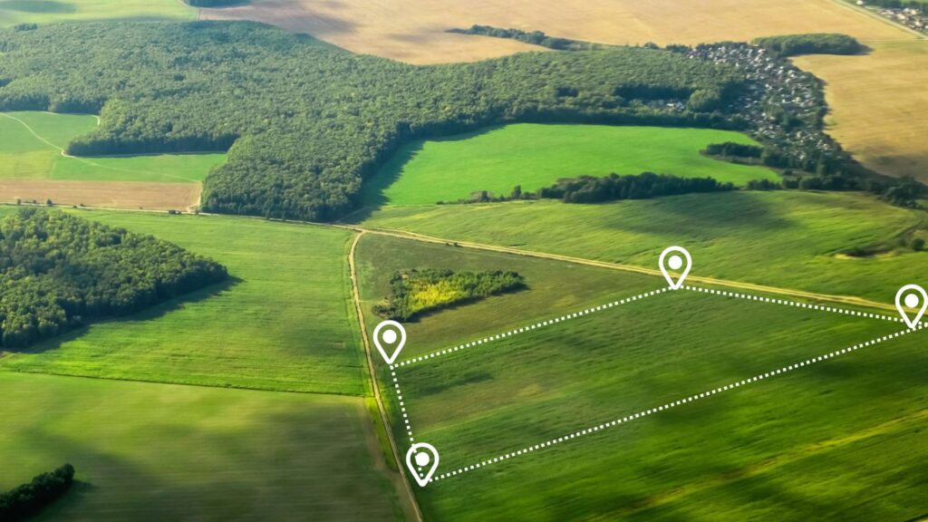
The Land App lets the users share online maps with all agriculture and property management third parties. Its functionalities are optimised for the needs of both estate agencies and individual users, and they fit the legislative regulations in the UK.
Project goals and needs
The Land App team had a great idea and MVP but needed a technology partner with an understanding of the geospatial domain that would take the product to the next level and take care of all software delivery lifecycle from designing via implementation, cloud optimisation, support and maintenance. The main purpose of the app was to allow the user to create an online map of an area of their choice, on their own, and by following a detailed manual.
Another important goal was achieving a product-market fit for the app. Once the collaboration with Spyrosoft has started, The Land App team has been able to focus on the business and product roadmap. This – in turn – allowed them to work faster and accomplish all the milestones they had planned for.
The collaboration with Spyrosoft
In the early days, activities and tasks revolved around tweaking and maintaining the solution while designing scalable and robust cloud-based and feature-rich next-gen solutions, but the team has grown as the scope of the project has become larger, and The Land App itself has evolved into a more mature product.
Thanks to the collaboration with our company, The Land App is now becoming a leading app in the nature capital and sustainability domain. It is currently used by more than 17000 users. The platform is also now being used by various public institutions, including national land registries and parks.
With the Land App achieving the product-market fit in 2019, the team is now ready for a surge of new users and adding new functionalities.
arrow_circle_right Our work
See other success stories of our clients
arrow_circle_rightContact
